Monday, August 1, 2005 -- Lake Louise /
Plain of Six Glaciers
We spent almost all of today doing the Plain of Six Glaciers Trail at
Lake Louise. The trail runs along the northwest side of the
lakeshore, then climbs upward to a teahouse (about 1200 ft rise), and
beyond that another few hundred vertical feet in less than a mile to a
"lookout" that is actually more like a scree slope, well packed by many
feet but still steep enough to be a bit scary about slipping.
The Internet is packed with information about this place, so I'll just
share out these pictures and a panorama.
First, of course, the map (click to enlarge).
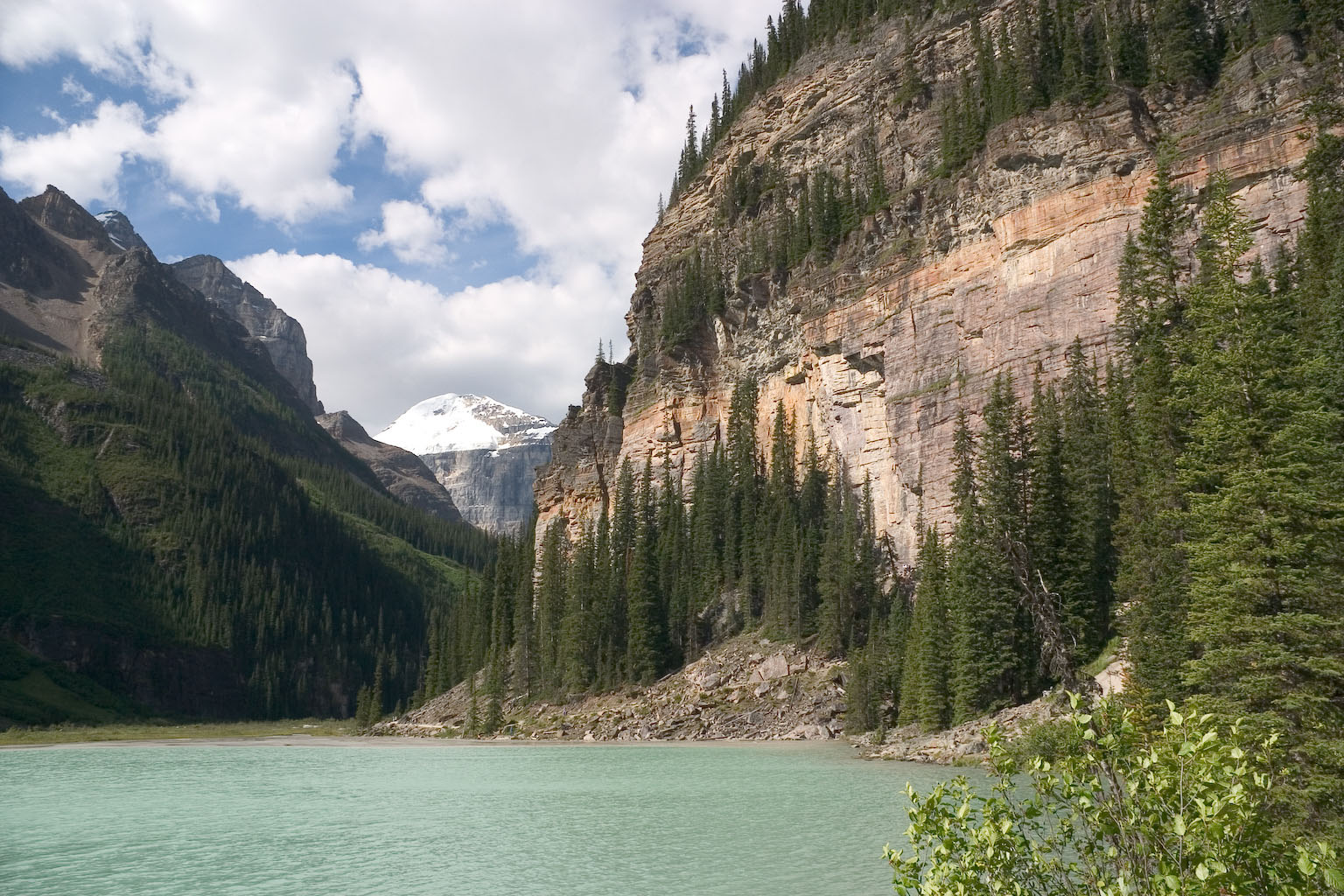
This is Mt. Victoria, looking across Lake Louise from the Chateau at
the northeast end. The Victoria Glacier, mostly covered with rock
at the bottom, can be seen flowing down the valley just left of
center. The Plain of Six Glaciers Trail lookout is at the top of
the upper scree slope to the right of the glacier.
Here is Mt. LeFroy, from partway down the lake. The Victoria
Glacier is flanked by Mt. Lefroy on the left (as seen here) and Mt.
Victoria (out of sight to the right).
Nearing the southwest end of Lake Louise, there are several places
where climbers practice their vertical rock skills. There are
actually some in this picture, right of image center. You can
barely see them in the expanded image.
Here's a little more obvious view of the climbers.
(Climbers-to-be, anyway.)
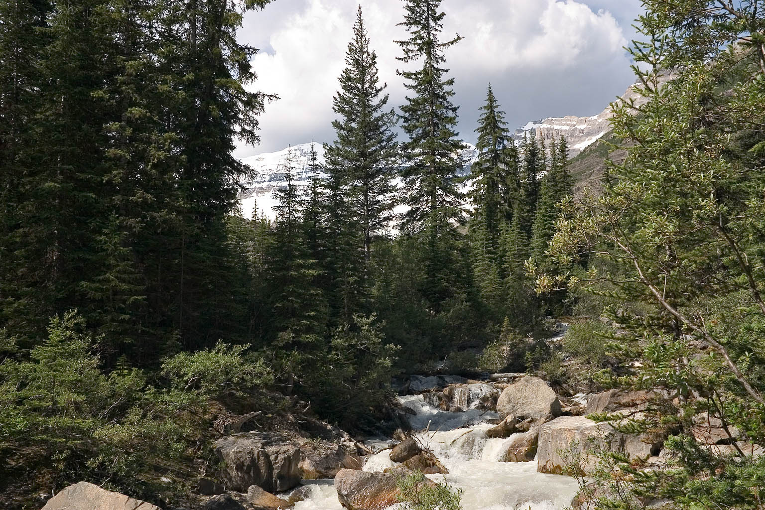
Just a happy little creek, on the way up. This is fed by the
Victoria and Lefroy glaciers. Yes, it looks like muddy milk.
The trail runs along a wide ledge here. There's exposed drop of
maybe 20 feet on the left. One of the regulars said that the
cable visible at lower right had been added within the last year or
two,
presumably for safety, or assurance at least.
Looking back toward Lake Louise and the Chateau.
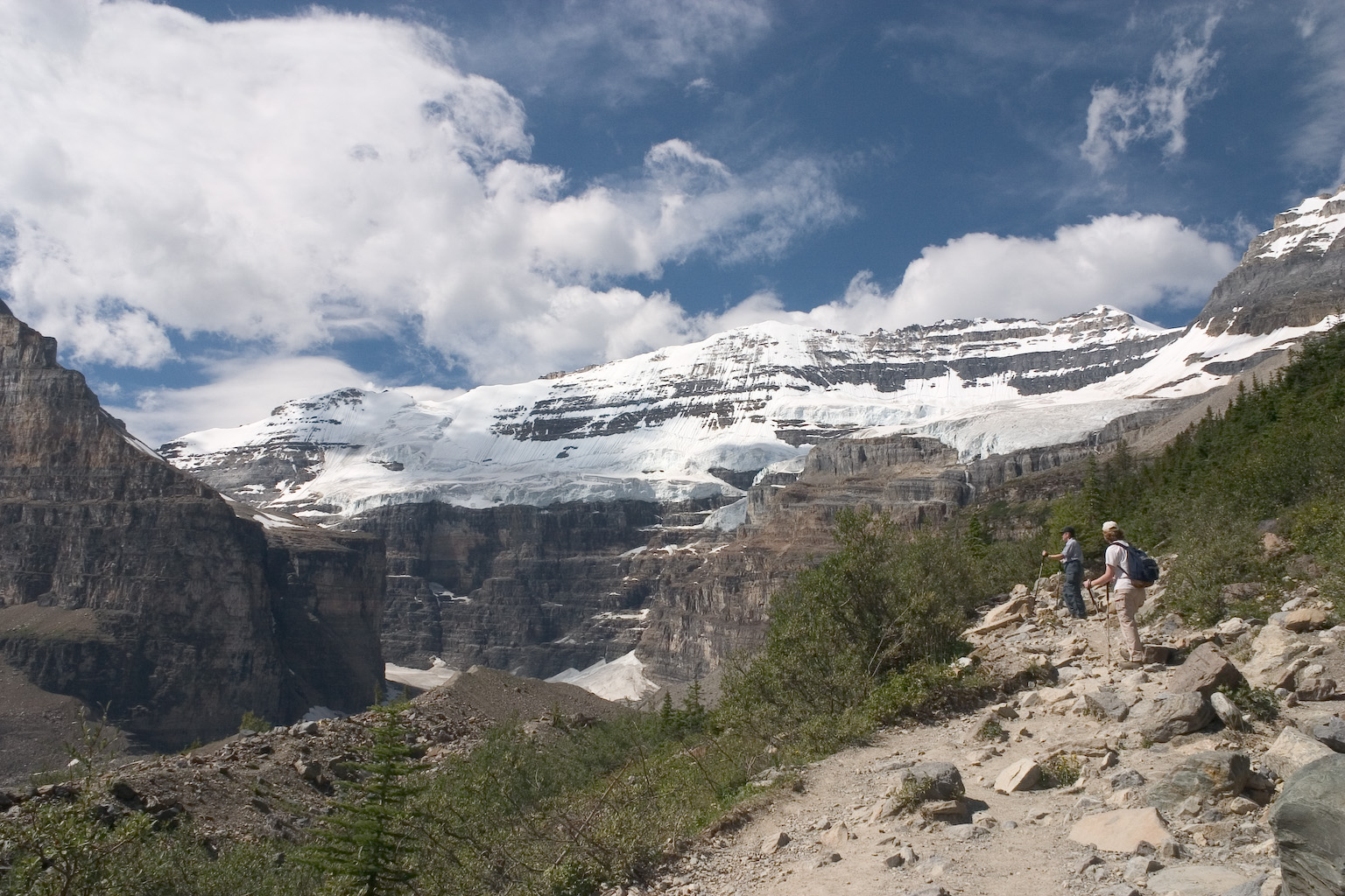
Looking up toward Mt. Victoria. The bottom cliffs of Mt. Lefroy
are visible at the left side. Most of the Victoria glacier is out
of site behind the large lateral moraine left over from colder times.
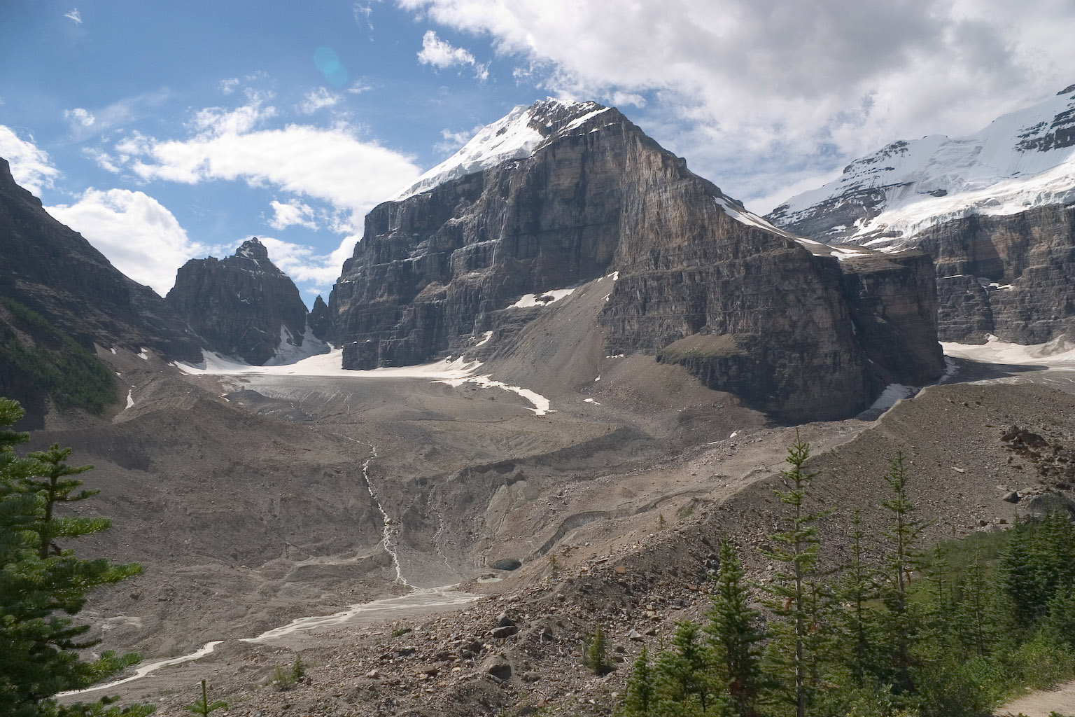
Mt.Lefroy and the junction of Lefroy and Victoria glaciers (left and
right, respectively). I think the Lefroy glacier actually ends up
where the stream starts. The Victoria glacier ends where the big
hole is, just below image center. On the way back down, we
encountered a climber who said that he and some friends had traversed
around the end of Mt.Lefroy on some ridiculously narrow ledge and
descended the big scree slope at the center of the picture.
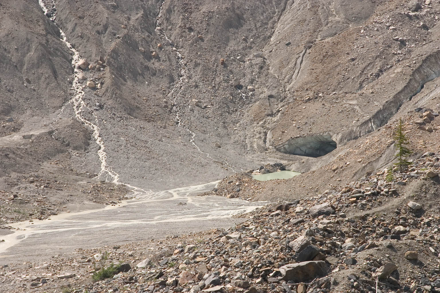
Here's a closer shot of the hole at the end of the Victoria Glacier.
Rik and Janis with Mt. Victoria in the background, Mt. Lefroy to
left. This is at the teahouse on Plain of Six Glaciers Trail.
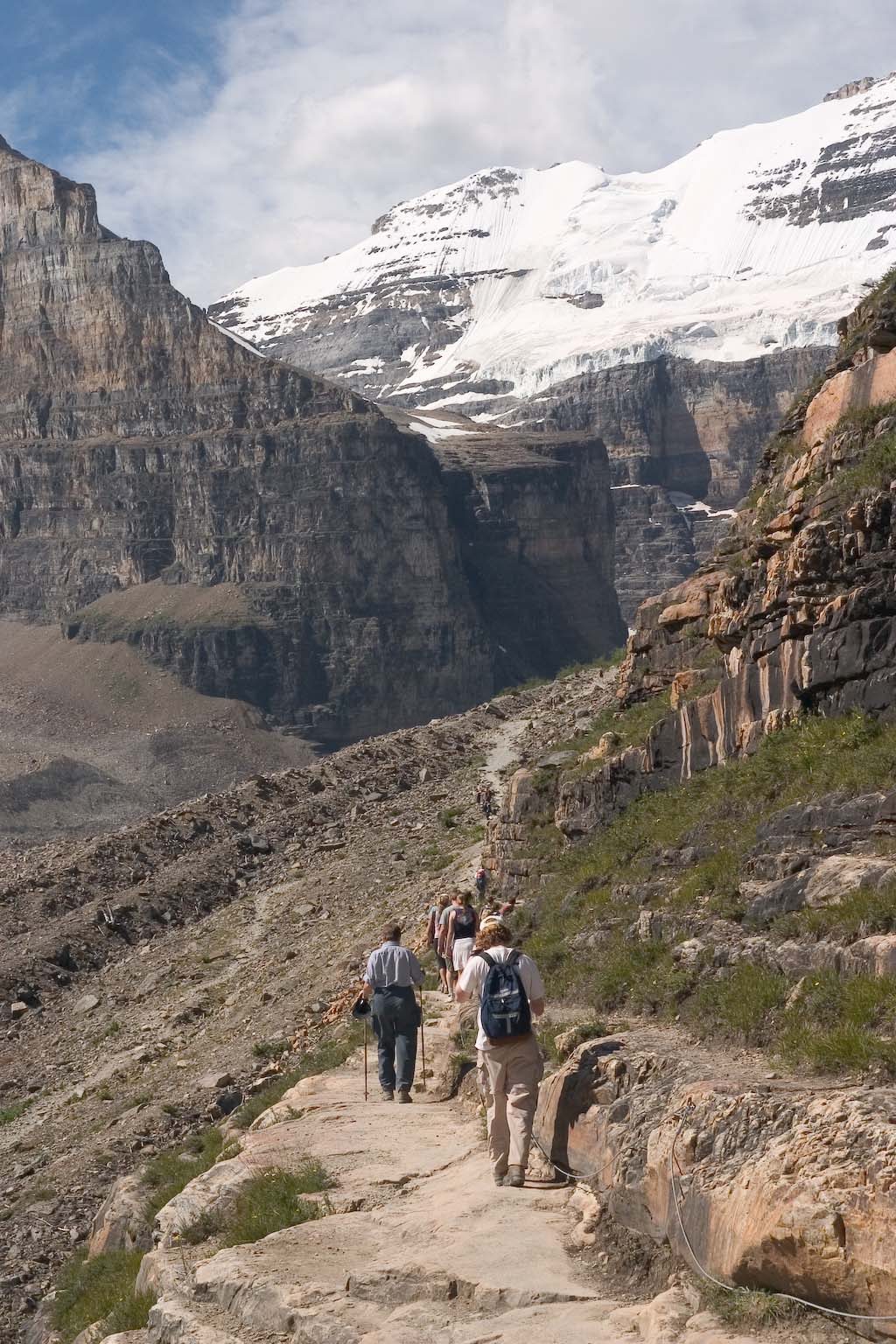
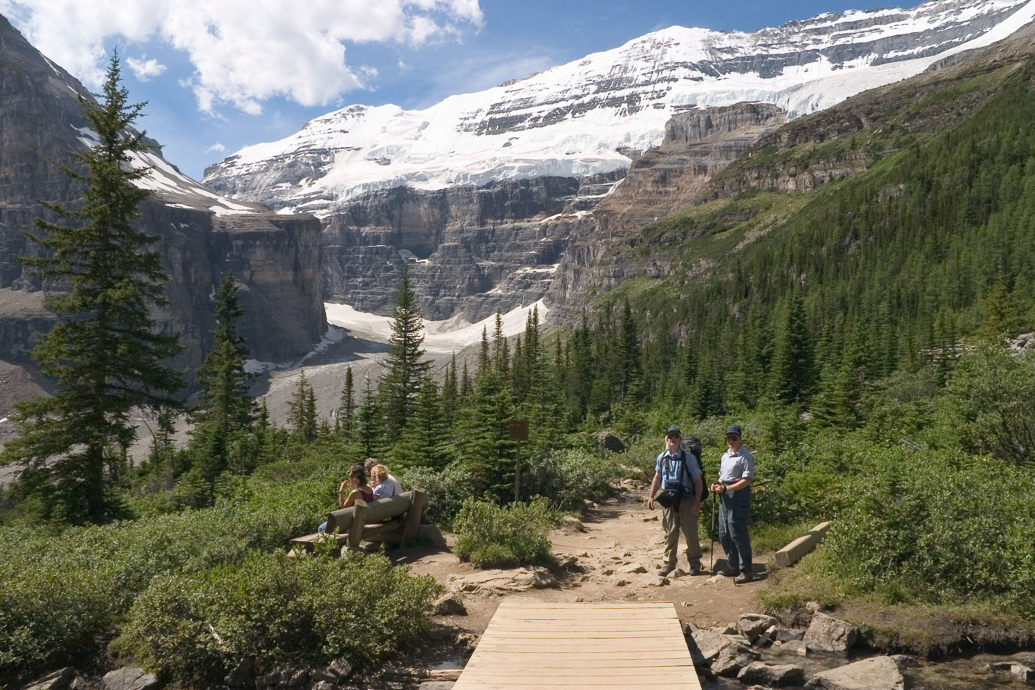
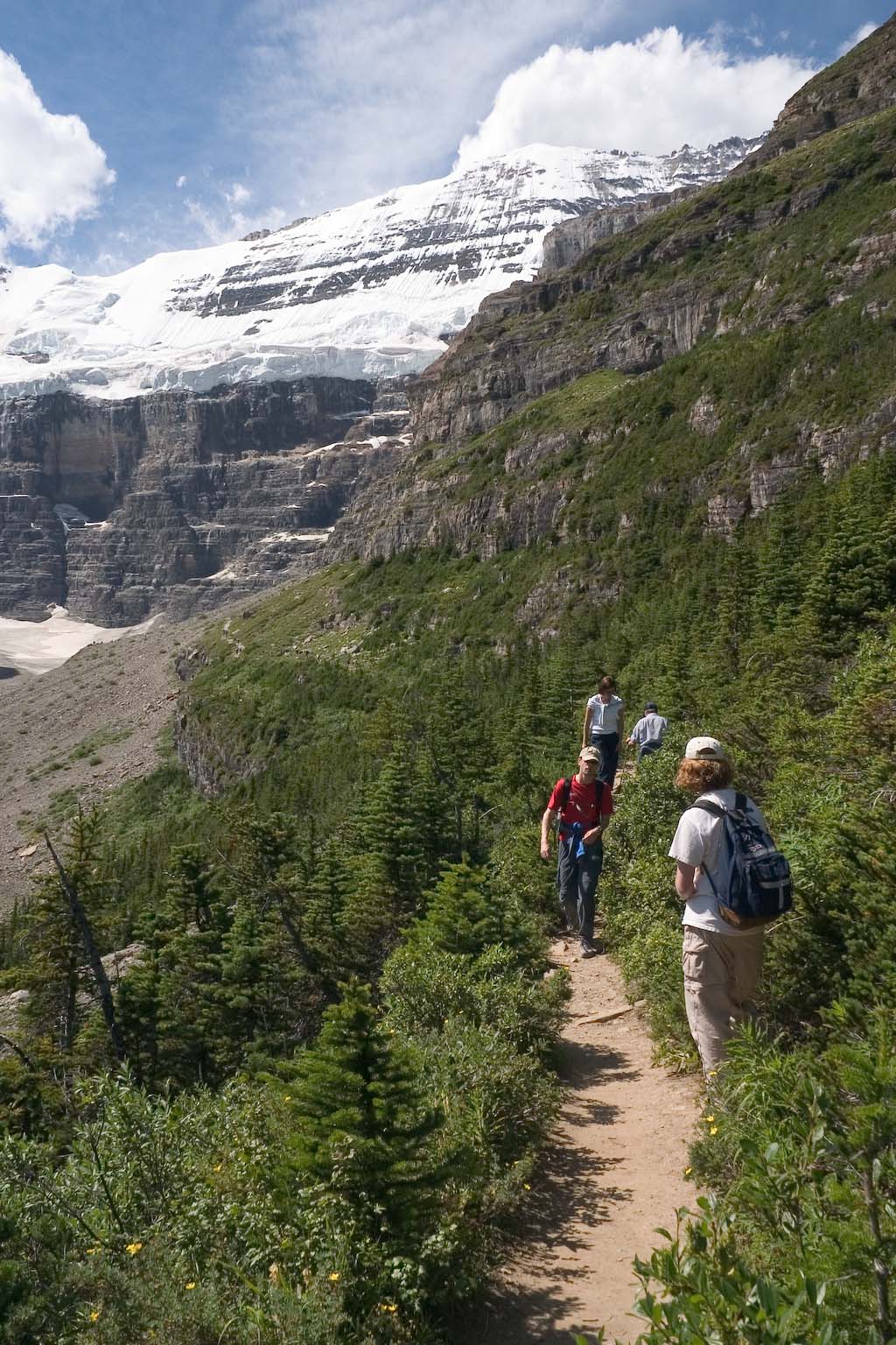
On the trail again, past the teahouse.
Approaching the end of the trail.
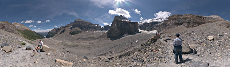
Full 360-degrees, Mt. Lefroy in the center. This is a "thumbnail"
for the panorama shown next.
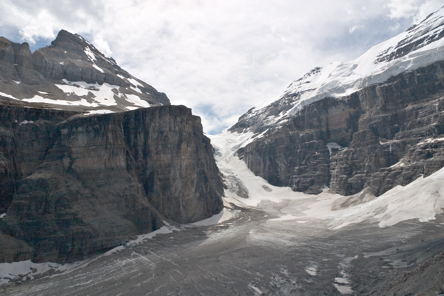
Here's the Victoria glacier spilling down between Mt.Lefroy on the left
and Mt.Victoria on the right. The low spot in the center is
Abbot's Pass. Just barely visible on the skyline in the pass,
there is a small dark spot. Keep that spot in mind.
The small dark spot is actually Abbot's Hut -- one of numerous such
buildings built on various high spots for climbers to stay in
overnight. All of the material got up there on human-back.
You can see several trails on the snow slope below the hut. Those
are footprints. They belong to the climbing group of the fellow
we talked with, who traversed the end of Mt.Lefroy after descending the
Victoria glacier through what's called "the Death Trap", if I am
reading the descriptions correctly.
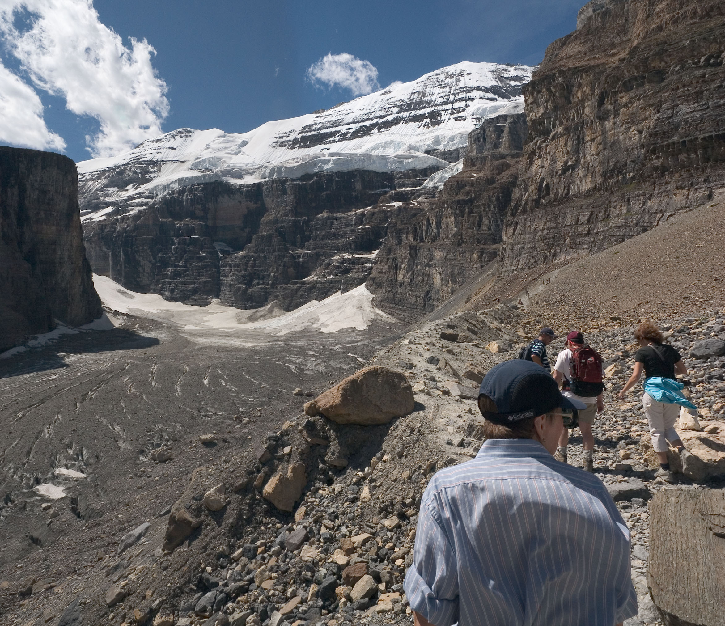
This shot gives a pretty good view of how steep the slope is, if you
happen to get off the trail. Right here, you'd have to be pretty
clumsy to do that. But at the very end, the trail goes vertical
on the slope. Since it's well packed and polished by many
visitors, slipping off would not be too difficult there.
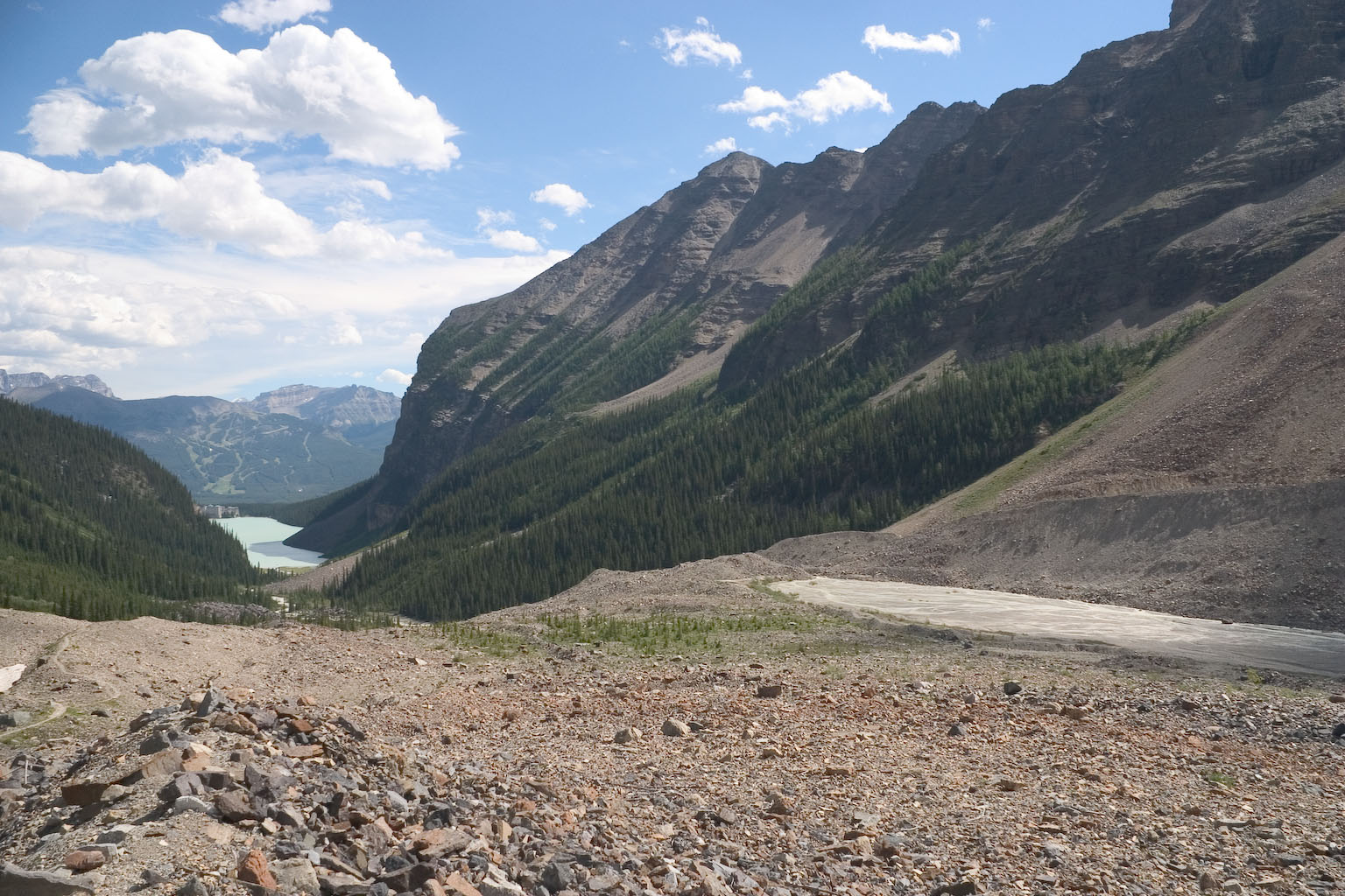
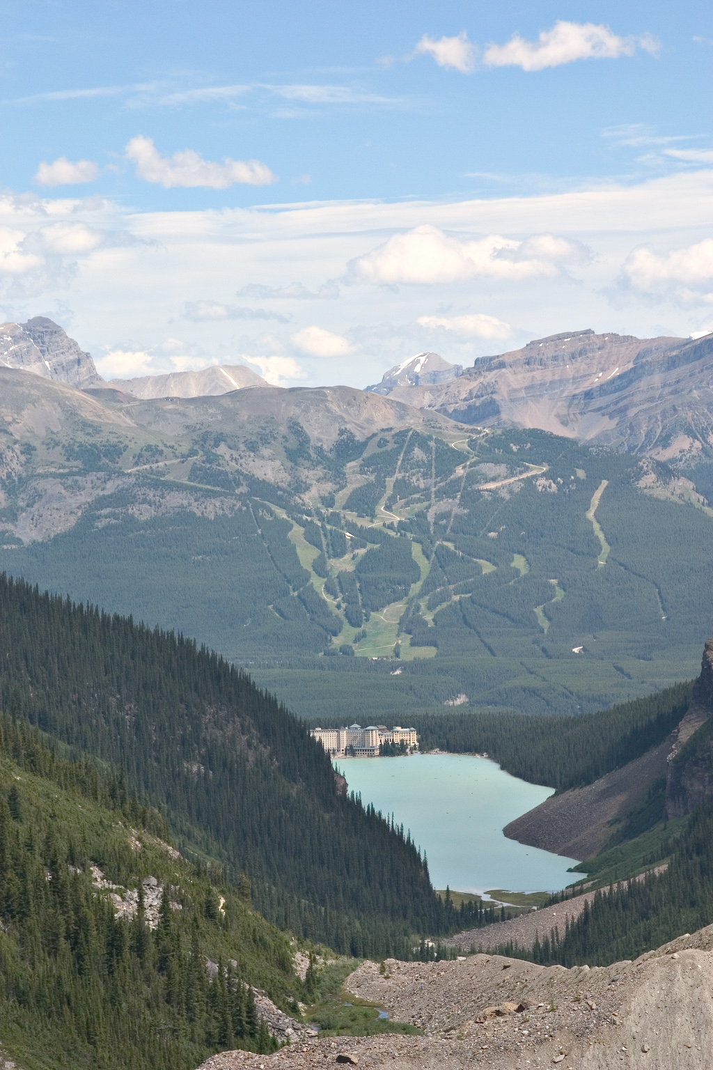
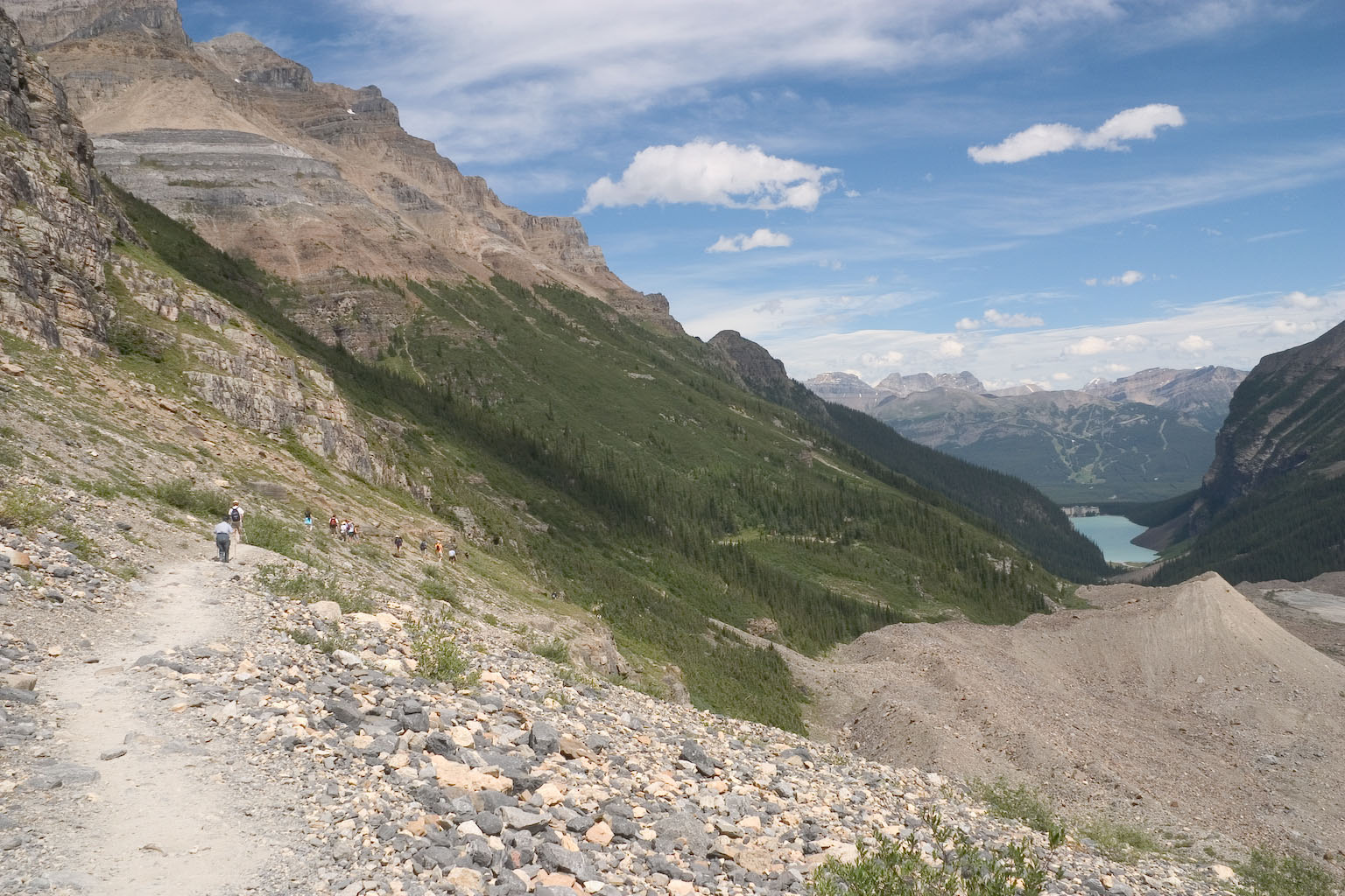
From well up on the trail, there's this great view of Lake Louise and
the Chateau. But beware, this is telephoto. The ski slopes
in the background are very far in the background -- on the other side
of the Bow Valley, in fact!
Same place, wider view.
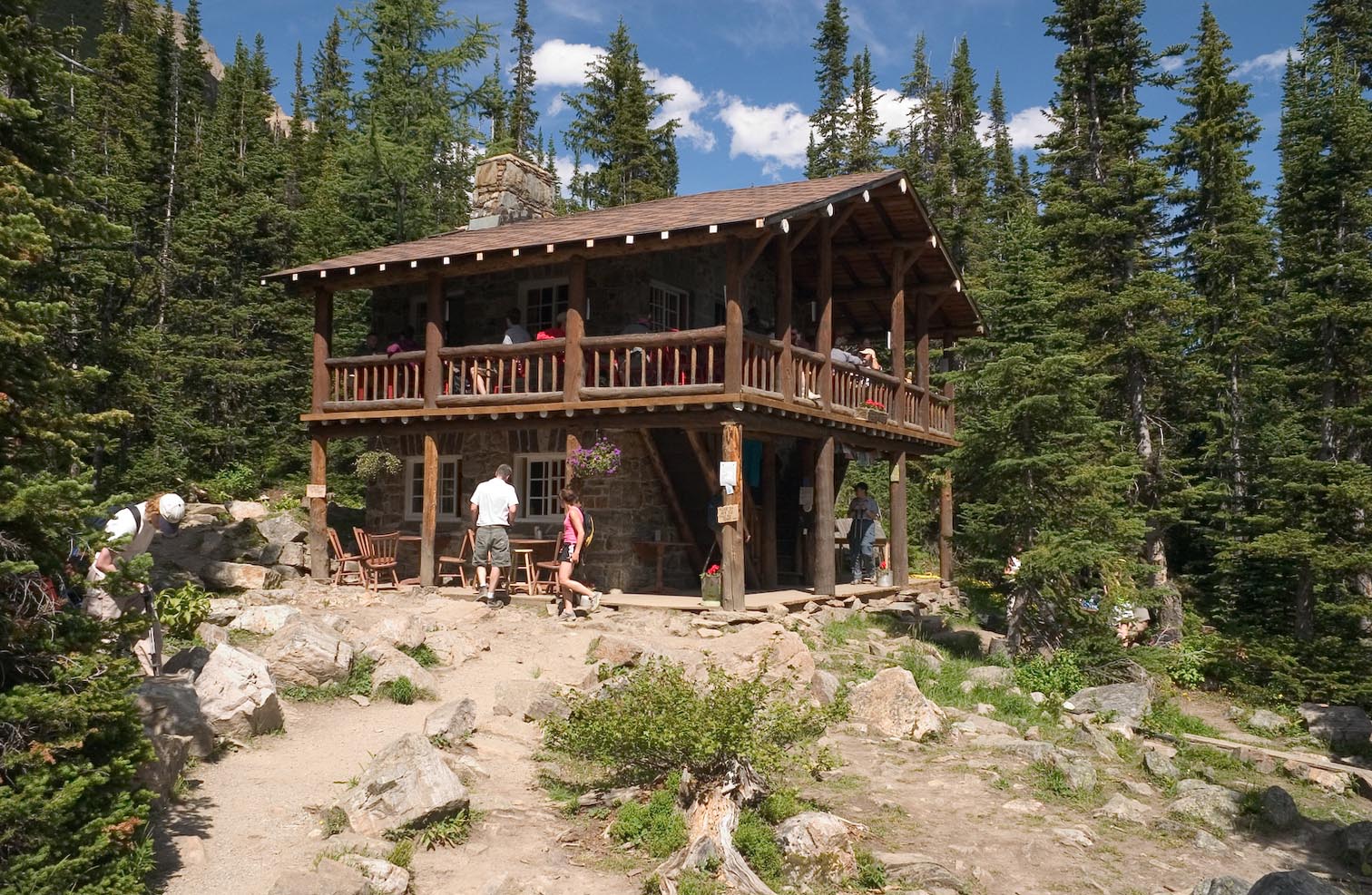
The Tea House...
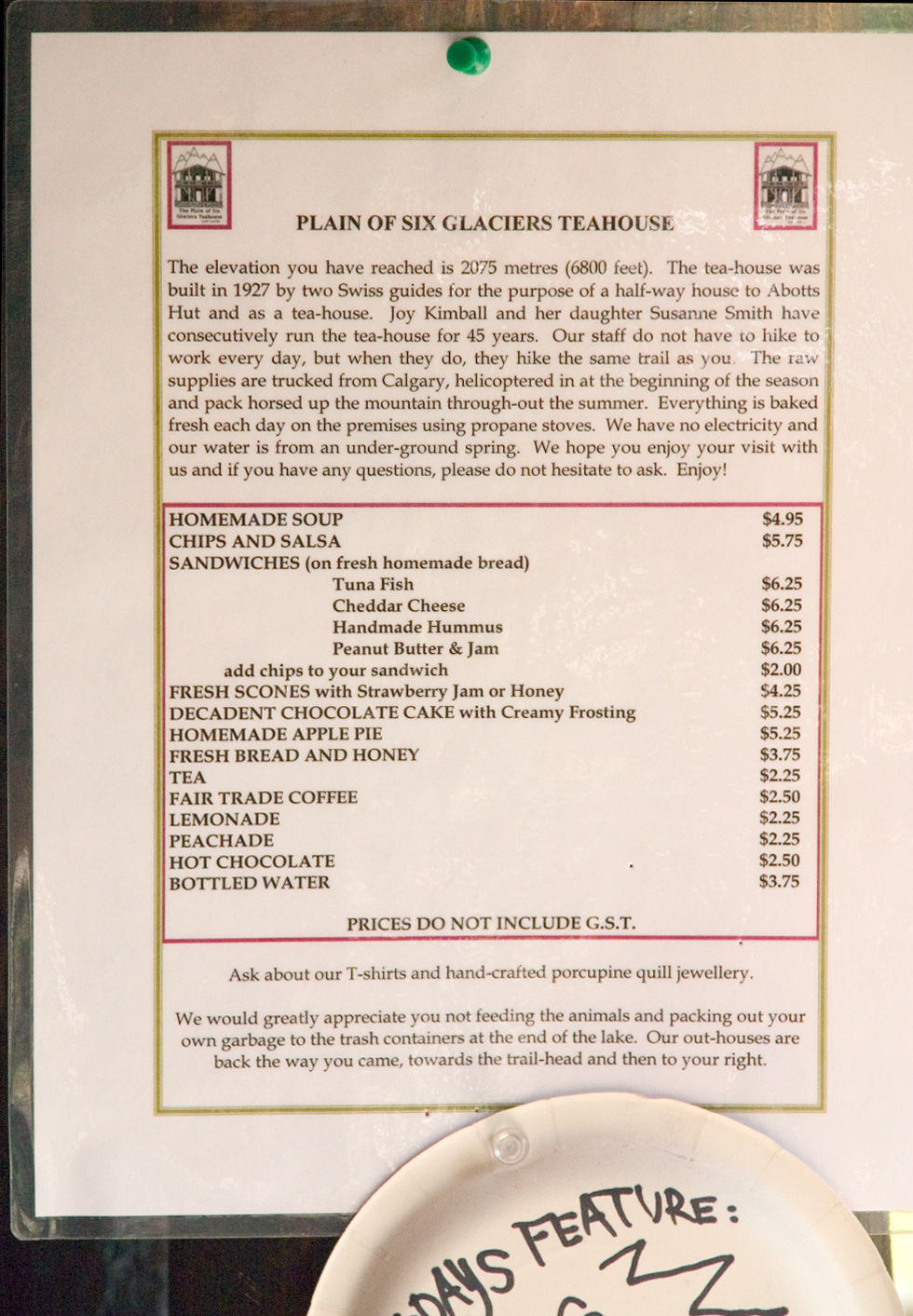
and the Tea House menu & information sheet. To our surprise,
the prices were actually quite reasonable, but we didn't stop to eat.